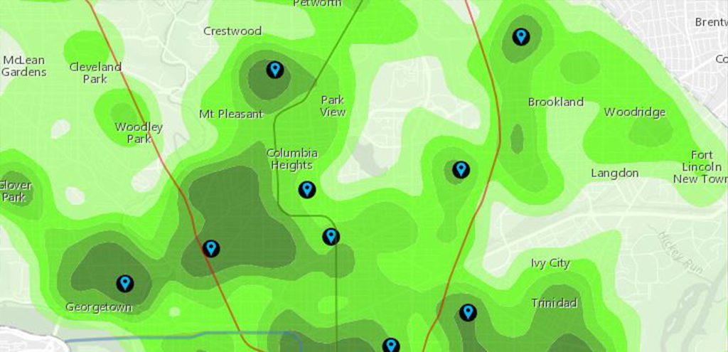
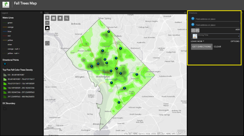
As we showcased last week, we built a map of the top 5 showy fall color trees in D.C. With this online map, you can now design routes around dense areas of colorful trees! The pinpoints on the map highlight the ‘epicenter’ of colorful areas, and are a great starting point for any walk, run, or stroll around the city.
Check it out! Maybe change your route to the Metro or bike ride home to another street that is bursting with color? A tip when to utilizing this map, you either need to sign on using your existing credentials (if you have an ESRI account), or create a free account (it takes approximately 30 seconds) with your email or social media handles.
Here’s how to design routes around colorful areas in the city? Use the directions widget.
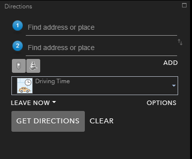
- To use the directions app, enter your current location or the location at which you will begin your journey (you can select metro stations, your current location or you can search for a location). If you would like to select a specific point follow the next steps:
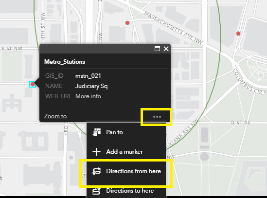
- Select the point,
- Select the three dots in the lower right hand corner.
- Select ‘Directions from here’ from the dropdown menu that appears.
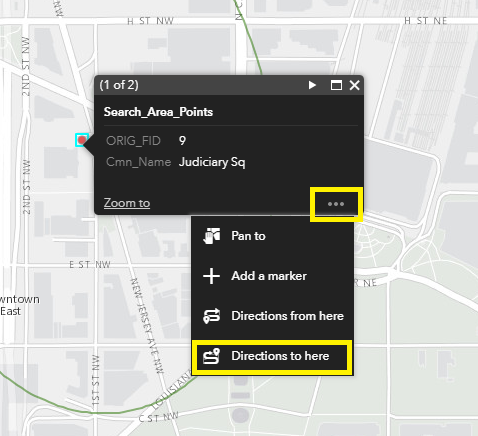
- Select a destination point
- Select the point at which you would like to end your journey (use the direction points displayed as black circles with blue location bubbles if you would like to find directions to areas containing all five fall color trees).
- Select the three dots in the lower right hand corner.
- Select ‘Directions to here’.
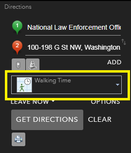
- Set mode to walking time or walking distance in the drop down menu.
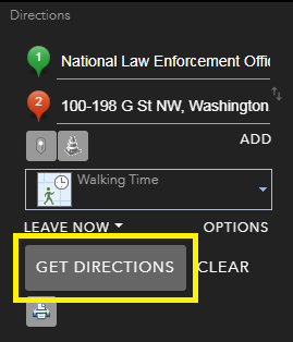
- Select the ‘Get Direction’ button.
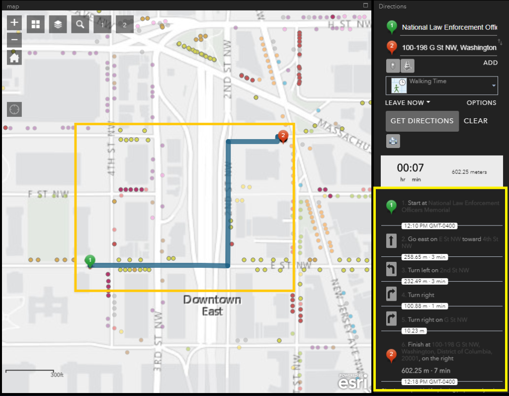
- Text directions will be given at the bottom left hand corner of the map, and street directions will be added to the map. Use care when following directions, and always pay attention to current traffic and hazards.
Some Helpful Tips About the Map
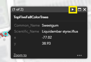 If you would like to get information about a particular tree simply select the point and a menu containing information about the feature will appear. You can use the next button to see other trees within the area. (Make sure that the directions widget is deselected when you select a tree.)
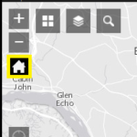
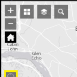
If you would like to go to the full map extent – click the house icon.
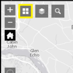
If you want to see the city in a different map style – click the grid icon.
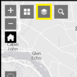
If you want to alter what information is displayed – click the layers icon.
If you would like to find your current location – click the compass icon.
 If you would like to expand the map to the full screen – click the border icon.